
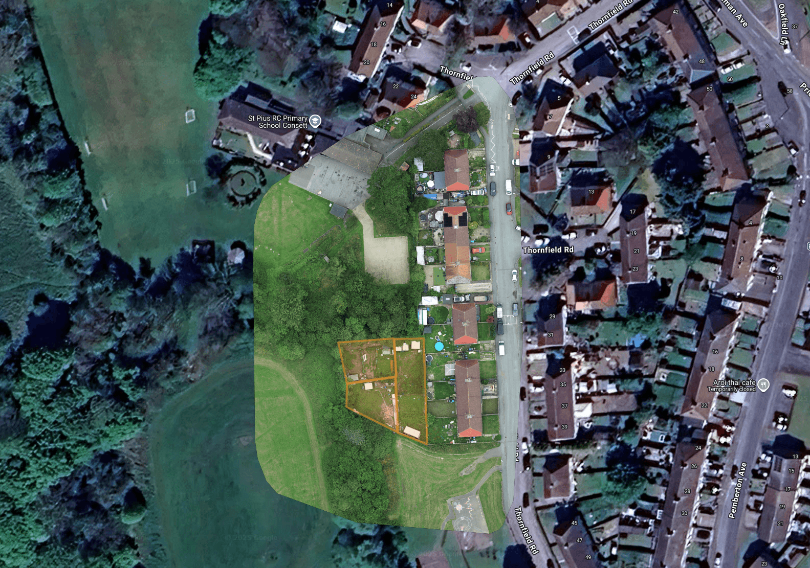
What Is Drone Site Mapping?
Drone site mapping photographs a site from above in a precise, overlapping grid, then stitches those images into a single high-resolution aerial map. The result, an orthomosaic, is a geometrically corrected, to-scale image of the whole site that you can measure distances and areas from and overlay onto Google Maps or your own plans. It's a fast, safe and cost-effective way to capture large areas of land, construction sites, quarries, farms and developments without walking every metre with traditional survey equipment. As a CAA-authorised, GVC-licensed and fully insured operator, we carry out aerial land surveys across the UK.
How the Drone Process Works
We define the survey area and plan an automated grid flight with the right overlap and ground sample distance (GSD) for the level of detail you need.
The drone flies the grid, capturing hundreds of overlapping, geotagged images at a consistent height and resolution across the whole site.
We process the imagery photogrammetrically into a single orthomosaic map, and can produce site measurements and indicative volume estimates where required.
You receive the finished orthomosaic and imagery, ready to overlay on Google Maps or share with your team.
Who It's For
Why Choose Drone Site Mapping?
Orthomosaic maps are geometrically corrected, so you can measure distances, areas and features directly from the image.
A drone maps many acres in a single flight, far quicker than ground survey, with no need to walk every metre.
Capture quarries, live construction sites and difficult terrain from the air, without putting surveyors in harm's way.
Re-fly a site as often as you like to track change, progress or stockpile levels over time.
What You Receive
Frequently Asked Questions
Areas We Cover
Based in Cumbria, we travel across the UK for survey and inspection work. We regularly operate throughout Cumbria and the Lake District, across the North West and North East, and up to the Scottish border, and take on projects nationwide.