
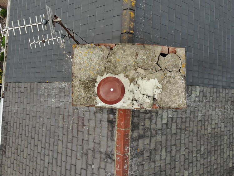
Aerial drone photograph of a building captured for an AI-assisted observation report

    AI-Assisted Building Observation Reports

    Spot visible problems early. Faster and cheaper than a full survey.

    What Is a Building Observation Report?

    A building observation report is a detailed, photograph-based record of a building or site that identifies visible signs of damage, deterioration and potential problems. We capture the property thoroughly, from the ground and from the air, then use AI-assisted analysis to turn it into a clear, severity-tagged report, usually in a fraction of the time and cost of arranging a full survey.

    Who It's For

    Property managers and landlords wanting a fast read on a building or portfolio
    Contractors and developers documenting a site before or after works
    Buyers and owners who want to know where the problems are before committing to a full survey

    What You Get

    Every Elevation Captured

    Every elevation and area photographed, from the ground and from the air, so nothing is out of reach.

    Report by Exception

    Each visible issue tagged by severity, described and marked up on the photograph.

    Full Photo Reconciliation

    A full photo reconciliation so nothing is dropped between capture and report.

    Fast Digital Turnaround

    Delivered digitally, quickly, so you can act on it without waiting weeks.

    Being Straight With You

    This is a visual observation report and lay opinion, not a chartered building survey. It flags what is visible so you know where to focus, and it is the ideal first step before commissioning a chartered surveyor. Drone Imagery Services is a drone operating company and is not a firm of RICS-registered surveyors.

    See Exactly What You'd Receive

    Take a look at an anonymised sample observation report, or explore our related dilapidation surveys and AI-powered survey data analysis.

    Frequently Asked Questions

    No. A building observation report is a visual observation report and a lay opinion, not a chartered building survey. It records and flags what is visible so you know where to focus. Drone Imagery Services is a drone operating company, not a firm of RICS-registered surveyors. It is an ideal first step before commissioning a chartered surveyor.

    Every elevation and area photographed from the ground and from the air, a report by exception with each visible issue tagged by severity, described and marked up on the photograph, and a full photo reconciliation so nothing is dropped. You get it as a fast digital turnaround.

    We capture the property thoroughly, then use AI-assisted analysis to help turn the imagery into a clear, severity-tagged report, usually in a fraction of the time and cost of arranging a full survey. It's priced per building or site, so get in touch for a quick quote, and we deliver it digitally with a quick turnaround.

    Yes. We publish an anonymised sample observation report so you can see exactly what you'd receive.

    We're based in Cumbria and travel UK-wide. Send us the property or portfolio location and we'll confirm.

    Areas We Cover

    Based in Cumbria, we travel across the UK for survey and inspection work. We regularly operate throughout Cumbria and the Lake District, across the North West and North East, and up to the Scottish border, and take on projects nationwide.

    CumbriaLake DistrictNorth West EnglandNorth East EnglandScottish BorderUK-wide

    Know Where the Problems Are Before You Commit

    Get in touch for a free quote. We're CAA-registered, fully insured and cover the whole UK from a Cumbria base. Call 07415 393960 or email info@droneimageryservices.co.uk.