
AI-Assisted Building Observation Report
Sample Building Observation Report
View the Sample Report
Turn through the full sample building observation report below. It is view-only. This is a visual observation report and lay opinion, not a chartered building survey: it flags what is visible so you know where to focus. Drone Imagery Services is a drone operating company and is not a firm of RICS-registered surveyors.
Summary of Observations
High severity
Medium severity
Low severity
This report records visible issues by exception. Areas photographed and found sound are logged in the full photo reconciliation but not repeated here. In a live report every elevation and area is captured from the ground and from the air, and each visible issue is tagged by severity, described and marked up on the photograph.
Observations
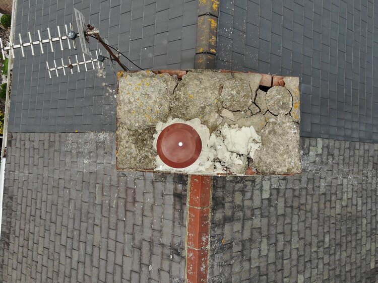 OBS-01
Roof / front elevation
Several ridge tiles appear lifted and mortar bedding looks failed. Water ingress risk. Recommend closer inspection by a roofer.
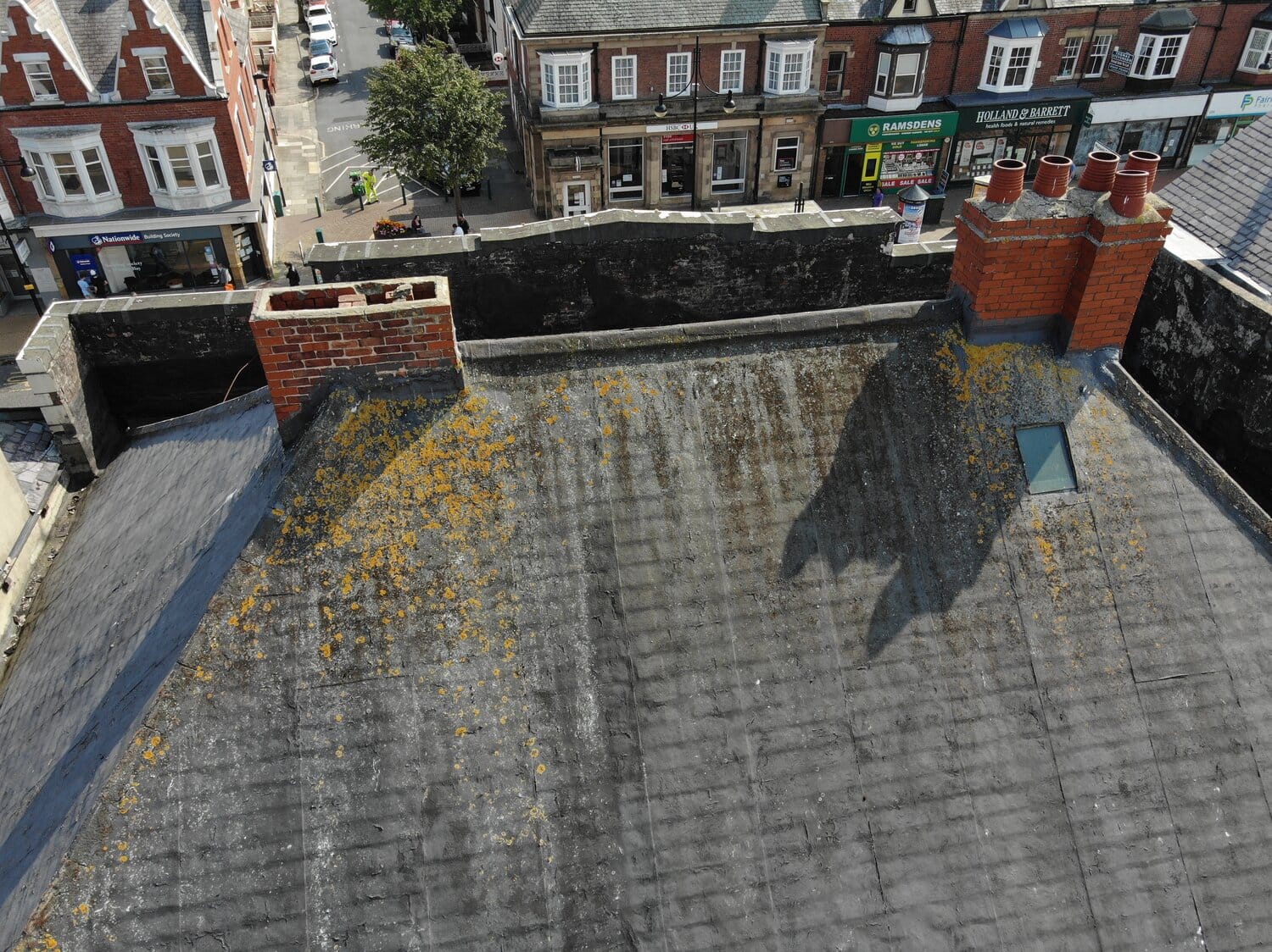 OBS-02
Rear elevation / gutter line
Vegetation growth and standing debris visible along the gutter run, with a section sagging away from the fascia.
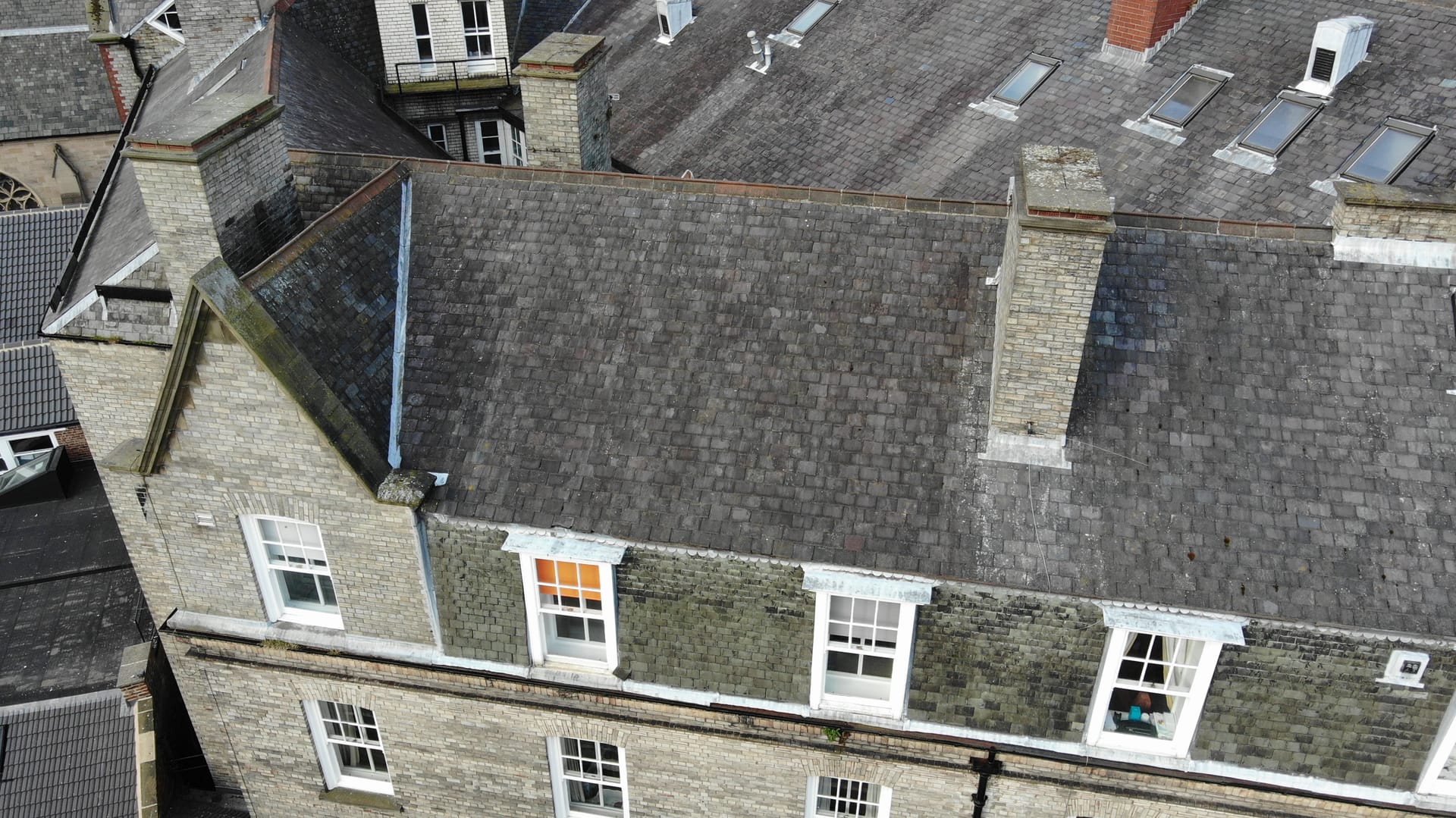 OBS-03
Side elevation / rainwater goods
Localised staining consistent with rainwater run-off. Cosmetic at this stage; monitor.
Every image captured on site is accounted for against the elevations and areas surveyed, so nothing is dropped between capture and report. The full reconciliation is included in the delivered report.
This is a visual observation report and lay opinion, not a chartered building survey. It flags what is visible so you know where to focus, and it is the ideal first step before commissioning a chartered surveyor. Drone Imagery Services is a drone operating company and is not a firm of RICS-registered surveyors.